
The land that is now the GNR has an interesting history. From at least 1832 gypsum has been quarried at the site, and it was the entrance to Weldon Gypsum Mine that tunnelled into the surrounding hills. Weldon Gypsum Mine was operated by JW Sheppard Ltd until 1935, when it was taken over by British Gypsum. The entrance to the mine was in the south-west corner of the current site boundary, and was served by a minerals tramway, initially using horses, and then a steam engine, which took the extracted gypsum rock on flat waggons to the plaster mill on the edge of the village. Around 1900 a branch line of the Great Central Railway terminated at the plaster mill.
Highly detailed maps exist for the area with 6 inch to the mile maps available from 1884.
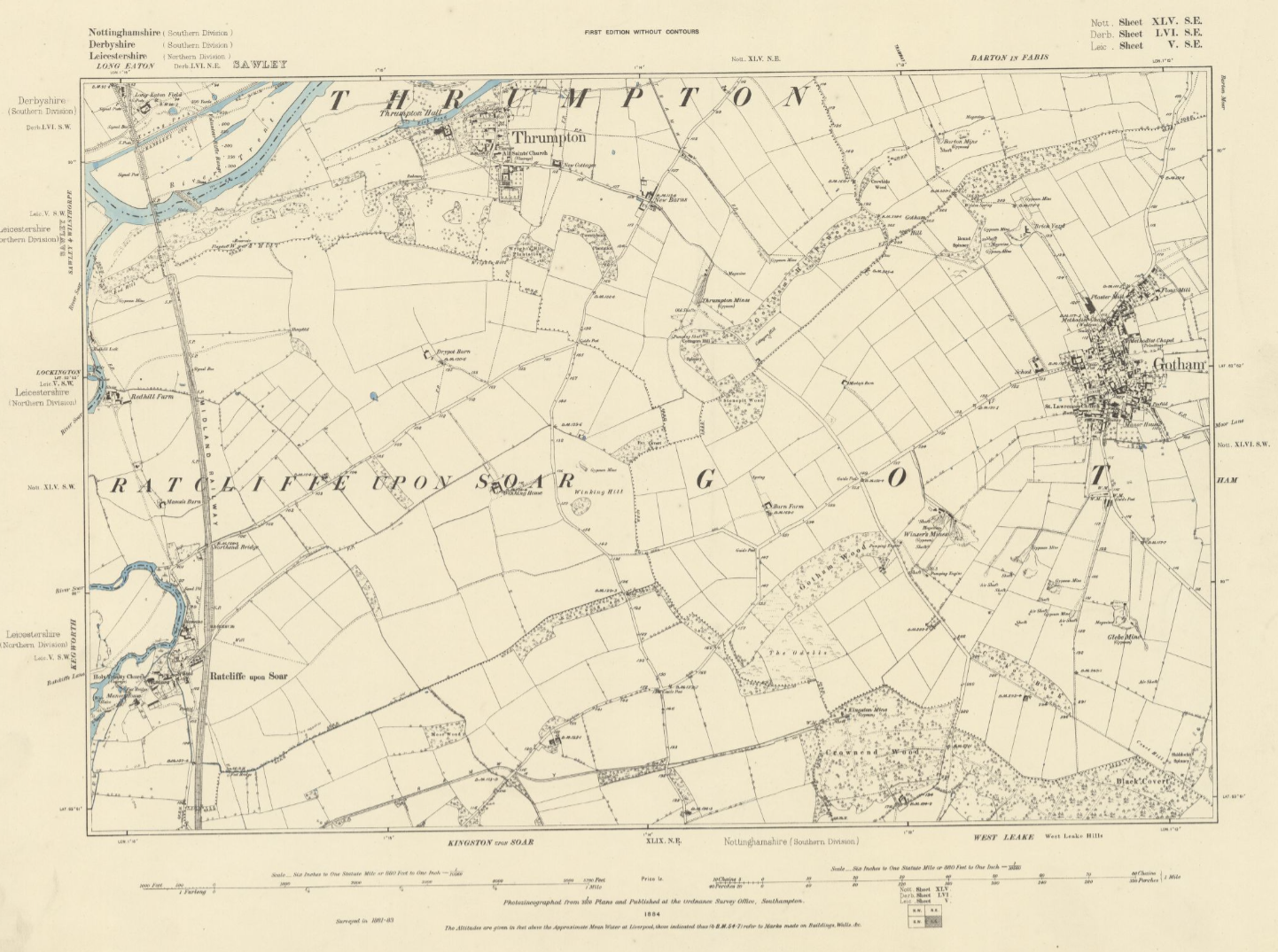
1884 OS Map Gotham 6 inch to the mile
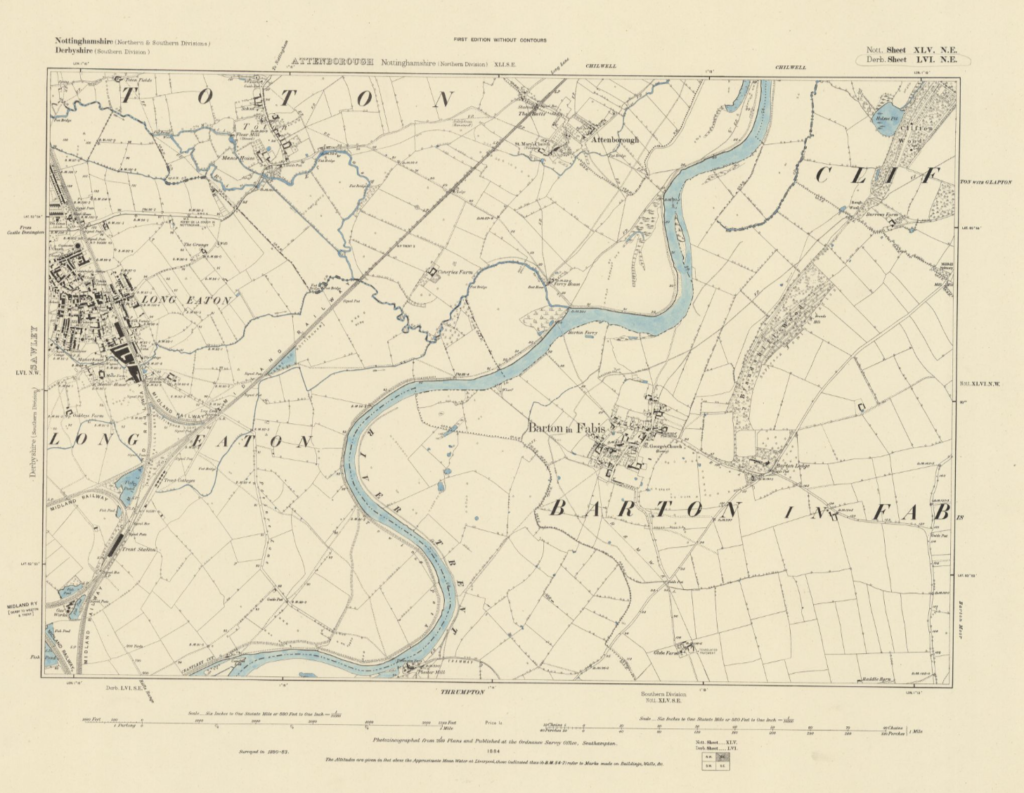
1884 OS Map Barton In Fabis 6 inch to the mile
The 1884 OS map shows a mine entrance on the site, along with a number of other mines and shafts in the immediate surrounding area. There are some buildings on the site and a ‘rail’ track probably horse drawn, leading to a plaster mill on the edge of the village, and a brick yard to the east. These maps also show a number of other gypsum mines scattered along both faces of the ridge, including Burton Mine, and Thrumpton Mines, both with tramways leading to wharfs on the Trent, along with ferry crossings at Thrumpton and Barton in Fabis.

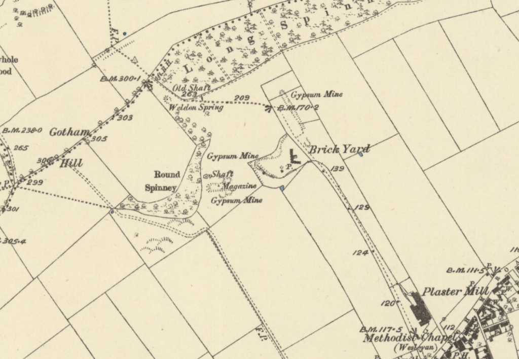
Details from the 1884 Map
The 1901 map highlights a few changes, identifying the site as Weldon Mine, and shows many of the nearby workings as disused. The Gotham Branch Railway line is under construction, with the route to the plaster mill clearly defined, but the track is only shown as far as the village school. some of the Thrumpton Mines have closed, but the tramway to a plaster mill on the riverbank in Thrumpton shows that extensive quarrying was still ongoing. Barton Mine and the two ferries are still in operation. This is the first map to show contour lines as well as spot heights.

Detail from the 1901 map
There are two maps from 1921, one was revised between 1913-1919, the other in 1919, both show much the same thing. On what is now the GNR, the buildings have all gone, along with any reference to a brickyard in the vicinity. A new tramway has been constructed along the route that now makes up the old tramway path along the south-west border of the GNR. Was this a response to replacing the horses with steam? This tramway was used to take gypsum to the plaster mill, and the Gotham Branch railway line is now complete, linking the plaster mill to the rest of the nation.
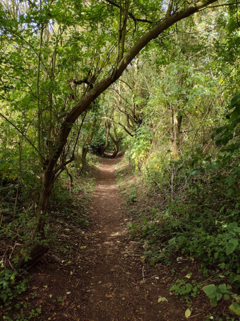
The route of the second tramway, now a path along the SW boundary of the GNR

Detail from the 1921 map
For much of the operating period, Weldon and Barton Mines linked together underground. Local stories tell how, during the first world war, the mines were used as a cut through for women in the village, walking to the Chilwell National Shell Filling Factory (via Burton Ferry). On 1st July 1918 there was a huge explosion which killed 134 workers and injured 250. Eight tons of TNT had detonated without warning, flattening large parts of the plant and damaging properties within a three mile area. The colossal blast was heard 30 miles away. Interestingly the 1921 maps of Chilwell were revised in 1913, so they (carefully?) omit the National Shell Filling Factory.

Women workers with shells in Chilwell filling factory 1917 IWM Q 30040
https://en.wikipedia.org/wiki/National_Shell_Filling_Factory,_Chilwell
1949 saw the publication of data revised in 1938, which shows little change in the area, however the plaster mill at Thrumpton is no more.
1955 saw the publication of the last 6 inch to the mile map. This one shows Weldon Mine as the last operational mine in the area. Both Barton and Thrumpton mines are disused, and both their tramways to the Trent have been removed. The ferries across the Trent are however still shown.

The Barton in Fabis ferry on the River Trent. Picture taken in 1949 by Arthur Beniston. CC-BY-3.0.

Detail from the 1955 map
Some time in the early 1960’s Weldon Mine closed, along with others around the village, and the railway branch line closed in 1965.
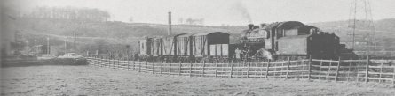
Goods train through Gotham in 1962
http://www.greatcentraltoday.com/gcrn/gotham.html
On the 1:2500 scale map from 1969, there is no longer a mine shown, and the tramway is labelled as dismantled (and now shown as a path). There is clear evidence of steep slopes and embankments on what is now the meadow area, and the current wooded area is showing as tussocky grass. The overhead power-lines and pylons are also clearly shown.
The Thrumpton Ferry is no longer showing, the Gotham Branch railway line has been dismantled. Quarry pits are starting to appear around Attenborough, however the Barton Ferry is still in existence. The 1974 map shows the site with its current boundaries. In 1983, twenty one acres of the hillside, including part of what is now the GNR, was designated as a SSSI.
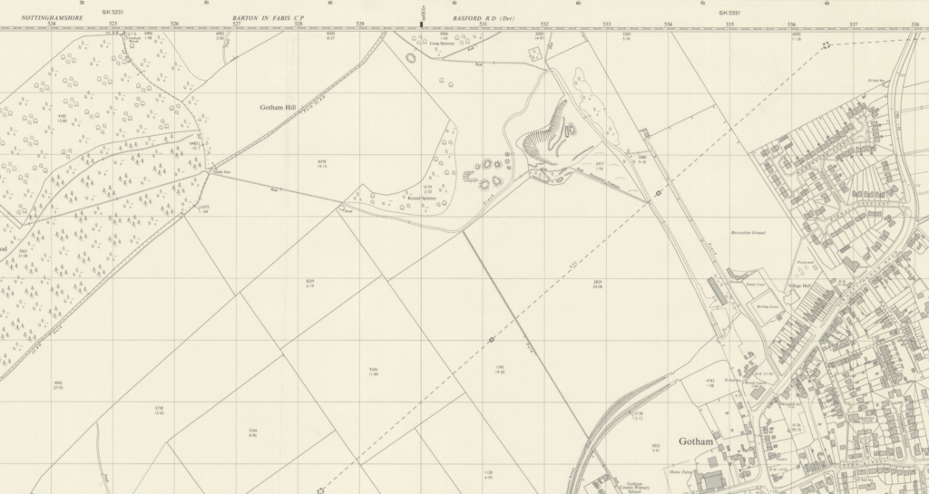
Detail from the 1969 map

Detail from the 1974 map
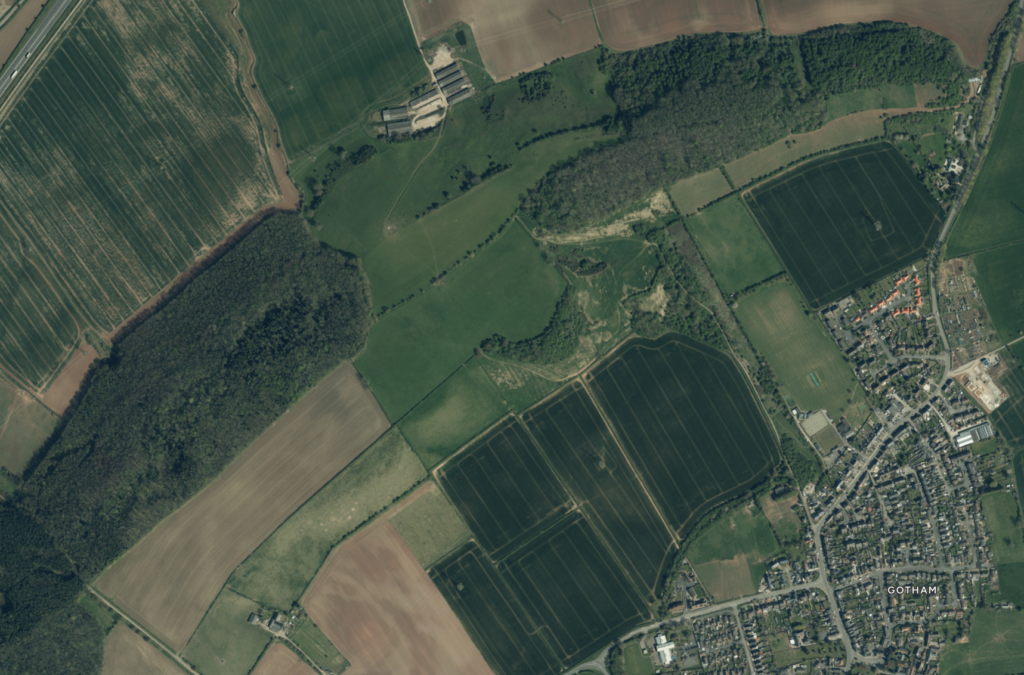
The GNR and surrounding area today

Close up ariel photographs reveal the presence of old gypsum mineworkings and spoil heaps from the Weldon Mine underlaying the grassland communities now thriving on the site.